Hydrology and Hydraulics Engineering
Water Resources Specialists
Hydrology • Hydraulics • Flood Management
Our Services

Hydrology & Hydraulics
Engineering

Bangladesh is among the world's most water-dependent nations — a riverine delta shaped by the Ganges, Brahmaputra, and Meghna systems, and exposed to some of the planet's most intense annual flooding. Understanding, modelling, and engineering these water systems is not just a technical challenge; it is essential to the country's economic survival and climate resilience.

Urban Engineering Limited provides rigorous surface water hydrology and hydraulic engineering services across the full spectrum — from catchment-scale flood modelling and drainage master planning to dam design, irrigation infrastructure, and waterway crossing hydraulics. Our analyses are grounded in field data, calibrated against Bangladesh's unique hydrological behaviour, and delivered to international standards.

35+

Water Studies

8+

Years Experience

7+

River Basins Covered
WHAT WE OFFER

Hydrology & Hydraulics Services

Comprehensive water engineering capabilities — from catchment hydrology and flood analysis to irrigation design and dam safety assessment.

Flood & Low-Flow Analysis

Frequency analysis of peak flood events and low-flow periods using statistical methods and rainfall-runoff modelling — providing design discharges for drainage infrastructure, bridges, culverts, and flood protection works across Bangladesh's diverse catchments.

Irrigation & Water Supply Design

Design of surface water irrigation systems, water supply intake structures, canal networks, distribution systems, and associated hydraulic control infrastructure — supporting agricultural productivity and rural water access across Bangladesh.

Run-of-River Intakes

Hydraulic design of run-of-river intake structures including siting analysis, sediment exclusion design, approach channel hydraulics, and screen and gate sizing — for hydropower, irrigation, and industrial water supply applications.

Bridges & Waterway Crossings

Hydraulic analysis of riverine bridge sites — scour assessment, waterway opening design, afflux calculations, and hydrodynamic modelling — ensuring bridge waterway designs are safe under extreme flood conditions and resistant to long-term riverbed scour.

Flow Monitoring Programmes

Design and operation of streamflow and water-level monitoring networks — including gauge station siting, rating curve development, continuous data collection, and hydrometric data analysis to build long-term records for water resources studies.

Storage & Flood Detention Dams

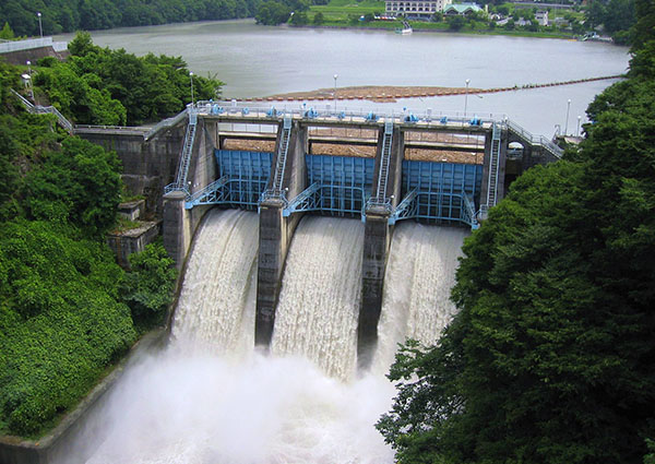
Hydrological design of storage reservoirs and flood detention facilities — including spillway sizing using PMF and design flood standards, dam-break analysis, routing calculations, and safety assessments for embankment and gravity dam structures.

Hydraulic Modelling
Tools & Methods

Advanced Hydrological & Hydraulic Modelling

Accurate hydrological and hydraulic analysis depends on choosing the right modelling tools, calibrating them against measured data, and interpreting results with engineering judgement. Our water engineering team applies internationally recognised software and methods to Bangladesh's complex hydrological environment.

Rainfall-Runoff Modelling

HEC-HMS and rational method applications calibrated to Bangladesh's IDF curves and BWDB gauge data — generating reliable design flood hydrographs for catchments of all sizes.

1D & 2D Hydraulic Modelling

HEC-RAS steady and unsteady flow models for rivers, floodplains, channels, and drainage networks — including 2D inundation mapping for flood plain delineation and flood risk assessment.

GIS & Remote Sensing Integration

DEM-based catchment delineation, land use mapping, and flood inundation mapping using GIS platforms — producing spatial outputs for drainage master plans and EIA submissions.

Climate Change & Scenario Analysis

Incorporation of climate change projections into design flood estimates — stress-testing infrastructure against future intensified rainfall and sea-level rise scenarios critical for Bangladesh's long-term resilience planning.

LOCAL EXPERTISE

Engineering Water for Bangladesh's Unique Environment

Bangladesh's hydrology is unlike anywhere else. Our team works with these conditions every day — not against them.

Monsoon Hydrology

Bangladesh receives 80% of its annual rainfall in the June–October monsoon window, generating rapid, high-magnitude runoff events. Our designs account for this extreme seasonality.

Low-Lying Delta Terrain

Much of Bangladesh lies near sea level on active deltaic deposits. Our drainage designs account for tidal backwater effects, waterlogging, and seasonal flood retention constraints unique to delta environments.

Dynamic River Morphology

Bangladesh's major rivers undergo rapid planform changes — bank erosion, channel migration, and avulsion are active processes. Our river engineering and bridge hydraulic designs account for morphological uncertainty.

Urban Flash Flooding

Rapid urbanisation and impervious surface growth have dramatically shortened concentration times in Dhaka and other cities. Our urban drainage models capture this and integrate green infrastructure solutions.

Transboundary River Flows

Bangladesh receives the combined flow of the Ganges-Brahmaputra-Meghna system from upstream India and China. Our hydrological studies incorporate transboundary flow records published by BWDB and partner agencies.

Climate Resilience

Infrastructure designed today will operate in a changed climate by mid-century. We apply IPCC-aligned climate change factors to all long-life water infrastructure — future-proofing designs against intensified flood and drought extremes.

OUR METHODOLOGY

Our Water Engineering Study Process

A rigorous, data-driven process from field investigation to final engineering design.

01
Data Collection & Field Survey

Acquisition of rainfall, streamflow, and water-level records from BWDB and BMD; bathymetric surveys; cross-section surveys; and geomorphological assessment of the study reach.

02
Hydrological Analysis & Modelling

Statistical frequency analysis, rainfall-runoff modelling, and design flood estimation for selected return periods — producing calibrated flood hydrographs and flow-duration curves.

03
Hydraulic Modelling & Design

1D/2D hydraulic model development, calibration, and scenario runs — translating hydrological outputs into water surface profiles, flow velocities, scour depths, and inundation extents for engineering design.

04
Reporting & Design Deliverables

Comprehensive study reports, hydraulic design summaries, design drawings, BOQs, and GIS flood inundation maps — formatted for regulatory submission, EIA incorporation, and construction procurement.

OUR ADVANTAGE

Why Choose Urban Engineering

Deep local data expertise, international modelling tools, and field-tested engineering judgement — applied to every water resources assignment.

Water Engineering Rooted in Bangladesh's Reality

Flood analysis • Irrigation • Drainage • Dam design

Our hydrologists and hydraulic engineers have spent their careers studying Bangladesh's rivers and drainage systems. We do not apply generic global templates — every study is grounded in locally collected data and calibrated to observable conditions.

BWDB Data Access

Long-standing working relationships with Bangladesh Water Development Board for access to historical gauge and rainfall records.

HEC-HMS & HEC-RAS

Industry-standard US Army Corps of Engineers hydrological and hydraulic modelling software applied on every project.

Climate-Ready Design

Climate change factors routinely incorporated into design flood estimates — infrastructure built for the climate of 2050, not just today.

GIS Flood Mapping

Spatial flood inundation maps produced for every project — enabling planners, regulators, and clients to visualise flood extents and depths.

Scour Engineering

Expert scour analysis for bridge foundations and river control structures — one of the most critical and often underestimated failure modes in Bangladesh.

EIA & Regulatory Support

Hydrology and hydraulics reports formatted and verified for submission to DoE, BWDB, and development partner environmental review processes.

Project References for Hydrology & Hydraulics Engineering

Explore our published portfolio for verified project references in MRT, roads, water, energy, marine, commercial, and residential infrastructure. For sector-specific case studies and client references, contact our team directly.

COMMON QUESTIONS

Frequently Asked Questions

Technical questions about hydrology, hydraulics, and water engineering in Bangladesh.

  • What is the difference between hydrology and hydraulic engineering?

    Hydrology is the science of how rainfall becomes runoff — quantifying how much water will flow from a catchment, when, and how frequently. It answers questions like: "What is the 1-in-100-year flood discharge at this point on the river?" Hydraulic engineering takes those flow quantities and analyses what happens when water moves through channels, structures, and floodplains — calculating water surface levels, flow velocities, scour depths, and pressures. Together, hydrology provides the "how much" and hydraulics provides the "what happens" — and both are essential inputs to the design of any water infrastructure in Bangladesh.

  • Scour — the erosion of riverbed material around bridge foundations during high-flow events — is one of the leading causes of bridge failure worldwide, and it is particularly severe in Bangladesh for several reasons. Bangladesh's rivers carry enormous sediment loads from the Himalayan and Meghalaya highlands; during monsoon floods, flow velocities and turbulence levels are extreme; and the alluvial sandy soils that make up most riverbeds in Bangladesh are highly erodible. Scour depths of 10–20 metres at bridge pier locations are not uncommon during major flood events. Urban Engineering's bridge hydraulic analyses always include detailed pier and contraction scour assessments to ensure foundations are embedded safely below the maximum scour envelope.

  • Bangladesh has a reasonably extensive network of hydrological and meteorological monitoring stations operated primarily by the Bangladesh Water Development Board (BWDB) and the Bangladesh Meteorological Department (BMD). For hydrological studies, we typically draw on: BWDB daily and hourly streamflow gauge records; BMD daily rainfall station data and satellite-based rainfall products; BWDB water-level records at tidal and non-tidal gauges; published IDF (intensity-duration-frequency) curves for Bangladesh derived from BWDB raingauge records; DEM data from SRTM or Bangladesh national topographic surveys for catchment delineation; and where site-specific data is sparse, we supplement with regional frequency analysis and nearby analogous catchment data. Field measurement campaigns (velocity gauging, cross-section surveys) are carried out where published data is insufficient for design confidence.

  • Yes — and this is one of our key strengths. Urban Engineering Limited's in-house capability spans the full chain from hydrological investigation through hydraulic analysis to the structural design of water infrastructure. For a bridge project this means we can carry out the catchment hydrology, the riverine hydraulic model, the scour analysis, and the structural design of the bridge and its foundations — all within a single integrated team. For irrigation schemes, we handle the hydrological yield analysis, the intake hydraulic design, the canal network hydraulic design, and the structural design of control structures. This integration eliminates the gaps, inconsistencies, and communication delays that arise when hydrology and design are split between separate consultants.